


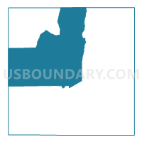
Voting District 0301, Carson County, Texas
About
Outline

Summary
| Unique Area Identifier | 671402 |
| Name | Voting District 0301 |
| County | Carson County |
| State | Texas |
| Area (square miles) | 234.77 |
| Land Area (square miles) | 233.73 |
| Water Area (square miles) | 1.04 |
| % of Land Area | 99.56 |
| % of Water Area | 0.44 |
| Latitude of the Internal Point | 35.46175480 |
| Longtitude of the Internal Point | -101.43909500 |
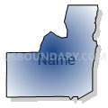
Maps


Graphs
Select a template below for downloading or customizing gragh for Voting District 0301, Carson County, Texas


Neighbors
Neighoring Voting District (by Name) Neighboring Voting District on the Map
- Voting District 0011, Hutchinson County, TX
- Voting District 0103, Carson County, TX
- Voting District 0201, Carson County, TX
- Voting District 0202, Carson County, TX
- Voting District 0302, Carson County, TX
- Voting District 0327, Potter County, TX
- Voting District 0401, Carson County, TX
- Voting District 0402, Carson County, TX
Top 10 Neighboring County Subdivision (by Population) Neighboring County Subdivision on the Map
- Borger CCD, Hutchinson County, TX (19,341)
- Canadian River Breaks CCD, Potter County, TX (5,266)
- Panhandle CCD, Carson County, TX (3,795)
- White Deer-Groom CCD, Carson County, TX (2,387)
Top 10 Neighboring Place (by Population) Neighboring Place on the Map
Top 10 Neighboring Unified School District (by Population) Neighboring Unified School District on the Map
- Borger Independent School District, TX (14,493)
- Highland Park Independent School District, TX (8,463)
- Panhandle Independent School District, TX (3,465)
- White Deer Independent School District, TX (1,648)
- Spring Creek Independent School District, TX (158)
Top 10 Neighboring State Legislative District Lower Chamber (by Population) Neighboring State Legislative District Lower Chamber on the Map
Top 10 Neighboring State Legislative District Upper Chamber (by Population) Neighboring State Legislative District Upper Chamber on the Map
Top 10 Neighboring 111th Congressional District (by Population) Neighboring 111th Congressional District on the Map
Top 10 Neighboring Census Tract (by Population) Neighboring Census Tract on the Map
- Census Tract 143, Potter County, TX (5,266)
- Census Tract 9505, Hutchinson County, TX (4,913)
- Census Tract 9502, Carson County, TX (3,795)
- Census Tract 9501, Carson County, TX (2,387)